Κυριακή, 16/11/2014


ΣΤΟ twitter


RSS
Δείτε τα νέα του Ακαδημαϊκού Λόγου μέσω RSS
 www.Alogos.gr Funding
| Παρασκευή, 16 Ιανουαρίου 2009 15:24 |
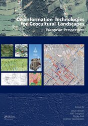
Geoinformation Technologies for Geocultural Landscapes European Perspectives Geoinformation Technologies for Geocultural Landscapes European Perspectives
1. Introduction: Research components linking papers; Data quality, scales, errors and accuracy; What is geo-cultural landscape; Are we interested in what modern man caused to the landscape?
2. Data capturing and mapping: Introduction; Vertical photogrammetry; Oblique aerial photography; Lidar; High resolution satellite image interpretation; Global Positioning Systems; Field data collection; Vectorisation and rectification of historical maps; Technical concept of WebGIS 3. Analysis and modeling: Introduction; Surface modelling; Linear landscape features; Landscape characterisation; Land use analysis; Landscape metrics; Geo-cultural modeling; Visualisation 4. Case Studies: a. Roscommon, Ireland; b. Lincolnshire, Great Britain; c. Thira, Akrotiri, Greece; d. Vindobona, Austria; e. Eastern Andalusia, Spain; f. Potenza valley, Italy; g. Eastern Andalusia, Spain; h. Potenza valley, Italy; i. Lac de Montady, France
Orders
Taylor & Francis Customer Services, c/o Bookpoint Limited
130 Milton Park, Abingdon, Oxon OX14 4SB, UNITED KINGDOM Tel: +44 1235 400524 - Fax: +44 1235 400525 Email: Αυτή η διεύθυνση ηλεκτρονικού ταχυδρομείου προστατεύεται από κακόβουλη χρήση. Χρειάζεται να ενεργοποιήσετε την Javascript για να τη δείτε. - www.taylorandfrancis.com |


Alogos WebTV